DEMOGRAPHICS PROFILE
The population distribution in Malabuyoc, Cebu, presents notable changes between 2015 and 2020. Montañeza stands out as the most populous barangay, comprising 16.25% of the total population, although it experienced a slight decrease of 0.53% over the five-year period. Santo Niño, with 13.76% of the population, demonstrated a positive change of 3.46%. Tolosa also saw a significant increase of 13.57%, comprising 8.17% of the total population. Conversely, Lombo and Armeña experienced declines of -7.91% and -6.50%, respectively. The overall population of Malabuyoc increased by 2.05% from 2015 to 2020, reaching a total of 19,770.
Barangay | Population percentage (2020) | Population (2020) | Population (2015) | Change (2015-2020) |
Armeña | 4.81% | 950 | 1,016 | -6.50% |
Cerdeña | 10.17% | 2,011 | 1,993 | 0.90% |
Labrador | 3.76% | 744 | 733 | 1.50% |
Lombo | 6.71% | 1,327 | 1,441 | -7.91% |
Looc | 5.93% | 1,173 | 1,218 | -3.69% |
Mahanlud | 3.06% | 605 | 554 | 9.21% |
Mindanao | 2.70% | 533 | 532 | 0.19% |
Montañeza | 16.25% | 3,212 | 3,229 | -0.53% |
Poblacion Dos | 5.93% | 1,173 | 1,189 | -1.35% |
Poblacion Uno | 8.97% | 1,773 | 1,638 | 8.24% |
Salmeron | 3.92% | 774 | 763 | 1.44% |
Santo Niño | 13.76% | 2,721 | 2,630 | 3.46% |
Sorsogon | 5.86% | 1,159 | 1,015 | 14.19% |
Tolosa | 8.17% | 1,615 | 1,422 | 13.57% |
Malabuyoc Total | 19,770 | 19,373 | 2.05% | |
Source: PSA 2020 | ||||
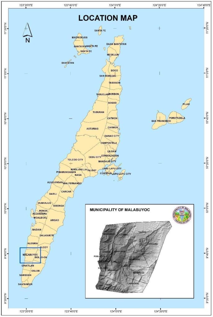
Municipality of Malabuyoc is located at the southwestern part of the Province of Cebu, 125 kilometers from the capital city of Cebu. It is bounded on the north by the Municipality of Alegria, on the south by the Municipality of Ginatilan, on the east by the Municipality of Boljoon and on the west by Tañon Strait facing the City of Bais, Negros Oriental.
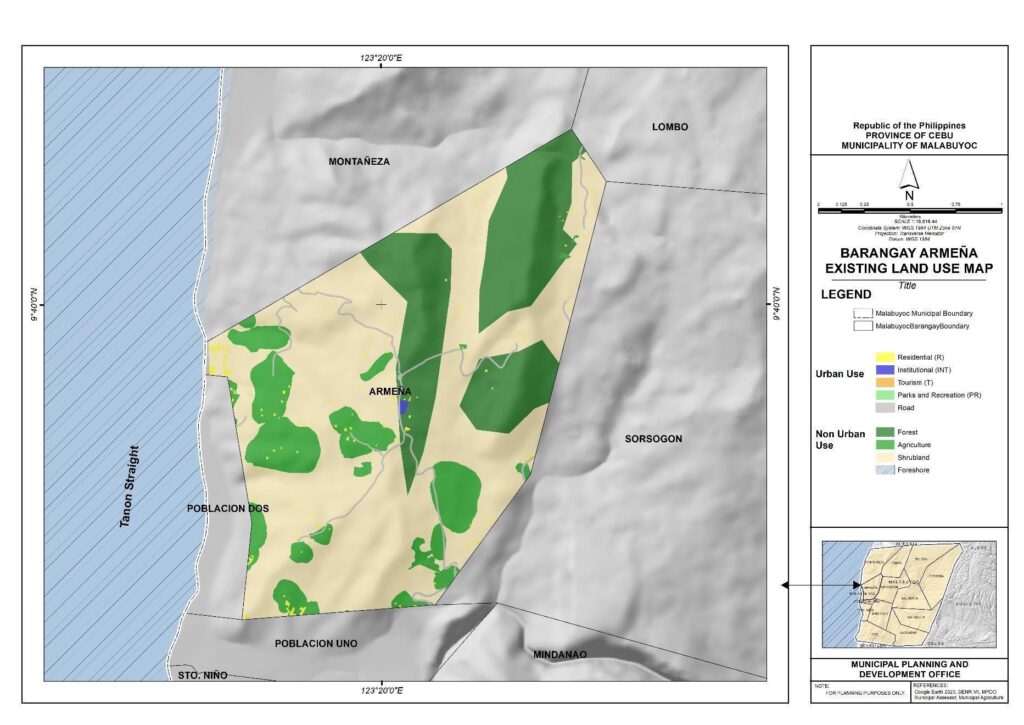
Barangay Boundary Map of Armeña
Armenia has total land area of 346.53 hectares. The predominant land use is shrubland, covering a significant portion of the area at 59.55%, followed by forest at 24.51%. Agriculture occupies 14% of the land, reflecting a mix of rural and cultivated spaces. Urban use accounts for a relatively small percentage, with roadways constituting 1.08%, residential areas at 0.72%, institutional zones at 0.08%, and parks and recreation areas at 0.01%. Foreshore and tourism areas are present in smaller area at 0.01 hectares and 0.14 hectares, respectively.
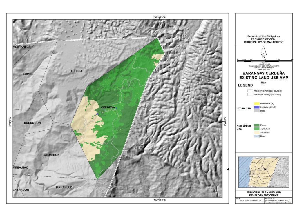
Barangay Boundary Map of Cerdeña
Barangay Cerdeña has a total land area of 1,324.86 hectares. As shown below, the predominant land use in Cerdeña is agriculture, encompassing 39.91% of the total area, followed closely by forest at 37.41%. Shrubland constitutes a significant portion as well, covering 21.31% of the land. Urban use is relatively limited, with roadways occupying 0.82%, residential areas at 0.32%, and institutional spaces at 0.07%. Additionally, there is a small percentage dedicated to river areas, at 0.15%. In summary, Barangay Cerdeña exhibits a predominantly rural landscape, characterized by extensive agricultural and forested areas with limited urban development
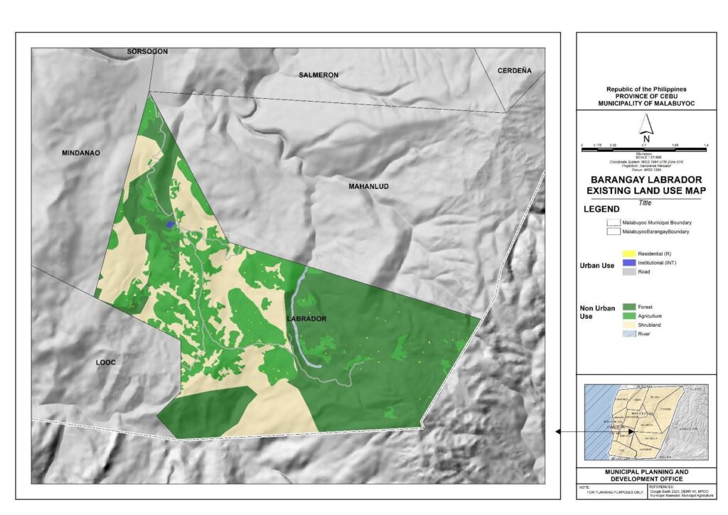
Barangay Boundary Map of Labrador
Barangay Labrador is characterized by a diverse mix of categories with a total area of 762.17 hectares. Forested areas occupy the largest portion, covering 46.72% of the total land area, followed by Shrubland at 26.39%. Agriculture accounts for 25.29% of the land, contributing to the overall natural landscape. Urban use is relatively limited, with roadways constituting 0.61%, residential areas at 0.20%, and institutional spaces at 0.06%. Additionally, there is a small percentage dedicated to river areas at 0.52%. In summary, Barangay Labrador reflects a predominantly rural environment with a significant emphasis on natural landscapes, particularly forests, agriculture, and shrubland, while urban development is relatively minimal.
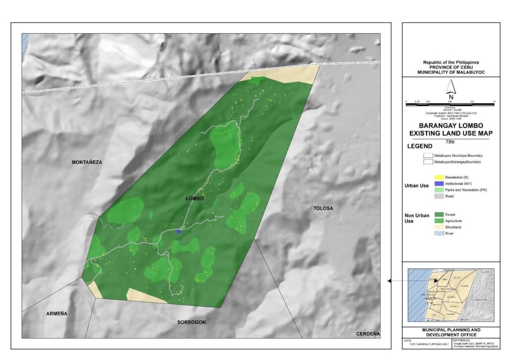
Barangay Boundary Map of Lombo
Barangay Lombo has a total land area of 562.03 hectares. The land use distribution is presented with a focus on various categories. Urban use is relatively limited, with roadways covering 3.95 hectares, residential areas at 2.30 hectares, institutional spaces at 0.26 hectares, and parks and recreation areas at 0.10 hectares. The predominant land use in Lombo is forest, occupying a substantial portion of 438.90 hectares. Agriculture covers 90.63 hectares, while shrubland and river areas constitute 25.60 hectares and 0.29 hectares, respectively
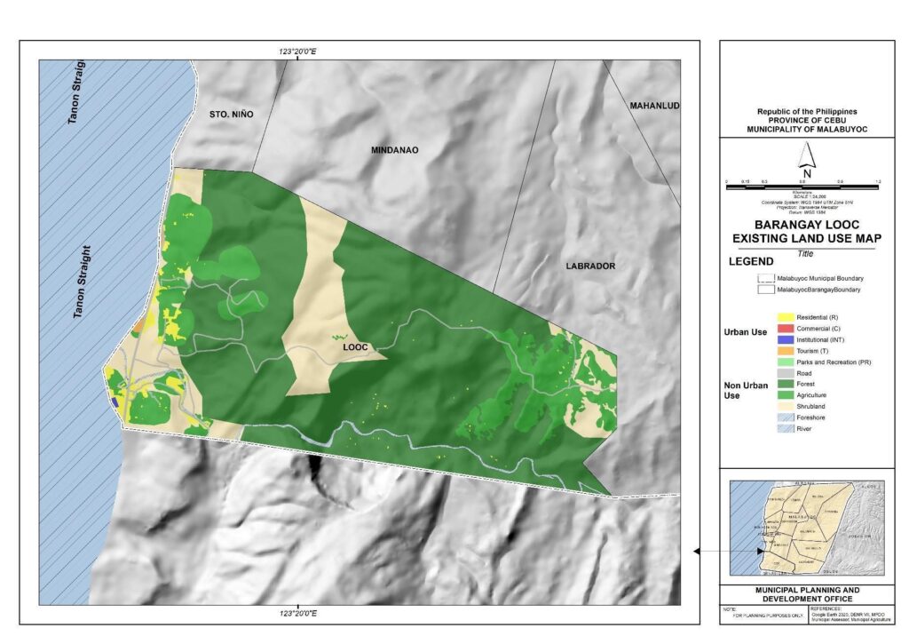
Barangay Boundary Map of Looc
Barangay Looc encompasses 650.59 hectares, reflecting a diverse land use pattern that includes both urban and natural features, as well as spaces dedicated to agriculture and tourism. The urban use category includes residential spaces covering 13 hectares, roadways at 7.47 hectares, institutional areas at 0.39 hectares, parks and recreation spaces at 0.05 hectares, and commercial areas at 0.02 hectares. The natural landscape is dominated by forests, which occupy a substantial portion of 407.12 hectares, along with agricultural areas covering 108.68 hectares. Shrubland covers 103.76 hectares, while foreshore and river areas contribute 1.21 hectares and 7.77 hectares, respectively. Additionally, there is a tourism area covering 1.12 hectares. Map 23 below depicts the existing land use map of Barangay Looc.
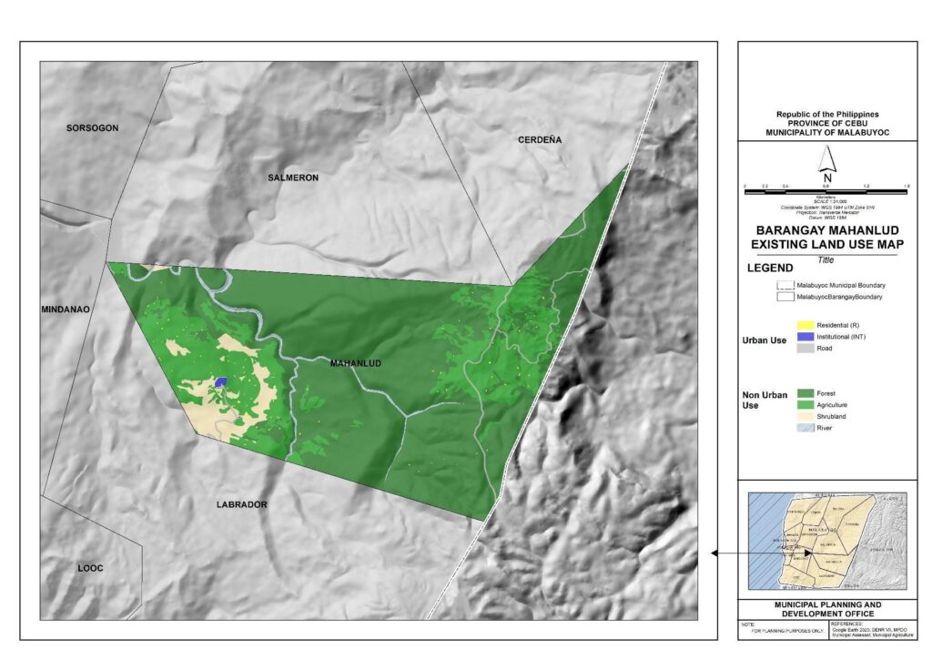
Barangay Boundary Map of Mahanlud
Map 24 depicts the existing land use map of Barangay Mahanlud. It has a total land area of 800.73 hectares. In terms of urban use, the barangay features roadways covering 4.35 hectares, residential areas at 1.43 hectares, and institutional spaces at 0.92 hectares. A significant portion of the barangay is characterized by natural landscapes, with a dominant forest area spanning 552.60 hectares. Additionally, agricultural land use covers 187.56 hectares, and shrubland areas span 37.31 hectares. The presence of river areas, totaling 16.56 hectares, contributes to the overall diversity of the landscape.
Barangay Boundary Map of Mindanao
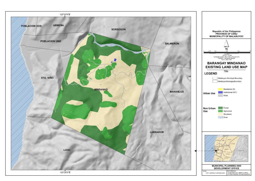
Barangay Mindanao’s existing land use is characterized by a mix of urban, natural, and agricultural areas. Urban use is represented by roadways covering 3.75 hectares, residential areas at 1.19 hectares, and institutional spaces at 0.44 hectares. Natural features include a substantial area of shrubland at 205.23 hectares, along with forested areas covering 191.09 hectares. Agriculture is present, occupying 111.02 hectares, while river areas contribute 9.40 hectares to the overall landscape. In total, Barangay Mindanao spans 522.11, showcasing a diverse land use pattern with a balance between urban development, natural elements, and agricultural activities.
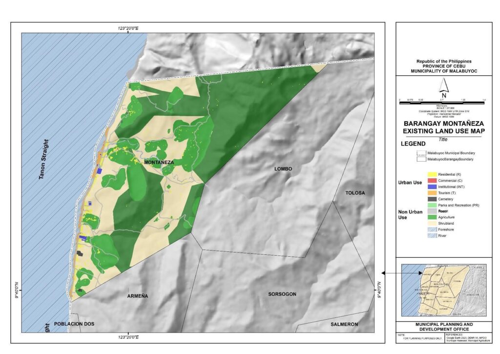
Barangay Boundary Map of Montañeza
Barangay Montañeza has a total land area of 747.03 hectares. The urban use category includes roadways covering 13.70 hectares, residential areas at 13.92 hectares, institutional spaces at 1.81 hectares, cemetery areas at 0.97 hectares, commercial spaces at 0.39 hectares, and parks and recreation areas at 0.08 hectares. Natural features are represented by forested areas covering 320.91 hectares and shrubland spanning 215.29 hectares. Agriculture is present, occupying 150.19 hectares, while foreshore and river areas contribute 21.45 hectares and 3.47 hectares, respectively. Additionally, there is a designated tourism area covering 4.87 hectares.
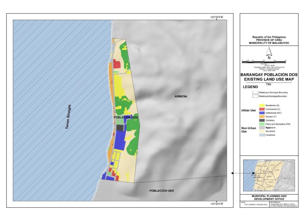
Barangay Boundary Map of Poblacion Dos
Poblacion Dos presents a diverse land use distribution, with a predominant focus on urban and recreational activities. Urban use includes residential areas covering 4.24 hectares, roadways at 2.41 hectares, institutional spaces at 2.61 hectares, commercial areas at 0.97 hectares, parks and recreation spaces at 0.68 hectares, and a cemetery area at 0.39 hectares. The presence of shrubland (9.89 hectares) and agriculture (5.95 hectares) indicates a blend of natural and cultivated spaces within the urban context. Additionally, there are designated foreshore areas (0.84 hectares) and tourism spaces (1.94 hectares), emphasizing the inclusion of recreational and coastal elements. In total, Barangay Poblacion Dos spans 29.93 hectares, showcasing a harmonious integration of urban infrastructure, green spaces, and recreational zones.
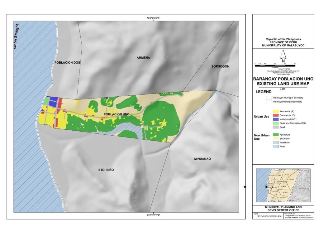
Barangay Boundary Map of Poblacion Uno
Poblacion Uno has a total land area of 60.65 hectares, which is composed of nine (9) existing land uses. Barangay Poblacion Uno showcases a primarily urban land use pattern, with a focus on residential and commercial activities. Urban use is represented by residential areas covering 9.09 hectares, roadways at 2.20 hectares, institutional spaces at 0.82 hectares, commercial areas at 1.13 hectares, and parks and recreation spaces at 0.37 hectares. Additionally, shrubland covers 18.52 hectares while agriculture at 24.11 hectares, indicating a mix of natural and cultivated spaces within the urban setting. The presence of river areas (4.04 hectares) and foreshore areas (0.36 hectares) contributes to the overall diversity of the landscape.
Barangay Boundary Map of Salmeron
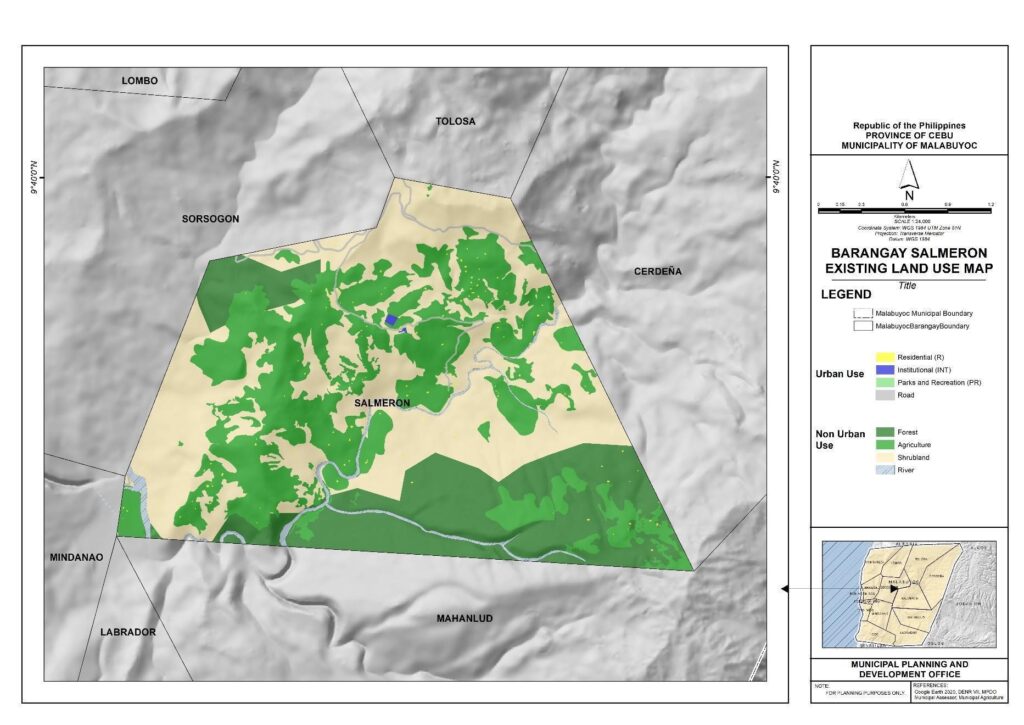
Barangay Salmeron shows a varied pattern of land use, distinguished by a blend of natural, agricultural, and urban areas. Roadways take up 3.82 hectares, followed by residential areas (1.46 hectares), institutional spaces (0.53 hectares), and a sparse area (0.02 hectares) devoted to parks and recreational places. A substantial 289.85 hectares of shrubland area and 246.60 hectares of agricultural area. There is also a forested area constitute the area’s natural features, covering 156.86 hectares, and 14.39 hectares of river areas enhance the landscape even further. Barangay Salmeron occupies 713.53 hectares in total, exhibiting the peaceful coexistence of natural landscapes, agricultural practices, and urban infrastructure.
Barangay Boundary Map of Sorsogon
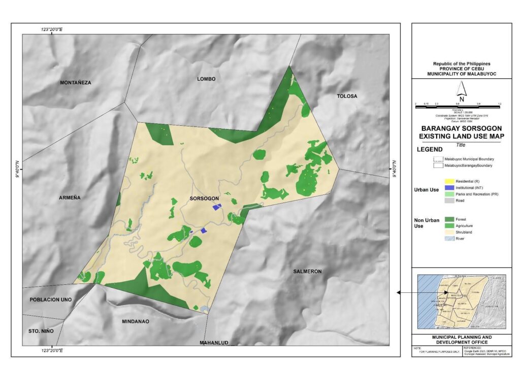
Barangay Salmeron shows a varied pattern of land use, distinguished by a blend of natural, agricultural, and urban areas. Roadways take up 3.82 hectares, followed by residential areas (1.46 hectares), institutional spaces (0.53 hectares), and a sparse area (0.02 hectares) devoted to parks and recreational places. A substantial 289.85 hectares of shrubland area and 246.60 hectares of agricultural area. There is also a forested area constitute the area’s natural features, covering 156.86 hectares, and 14.39 hectares of river areas enhance the landscape even further. Barangay Salmeron occupies 713.53 hectares in total, exhibiting the peaceful coexistence of natural landscapes, agricultural practices, and urban infrastructure.
Barangay Boundary Map of Sto. Niño
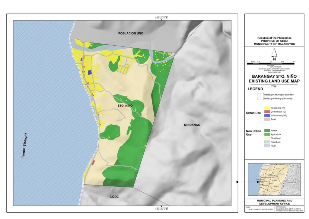
The current land usage in Barangay Santo Niño, Malabuyoc, is depicted on Map 30. The barrio’s ten (10) current land uses make up its 151.72 hectare total land area (Table 25). Residential areas make up a sizable 19.44 hectares of urban use, whereas roads occupy 4.96 hectares, commercial space occupies 0.49 hectares, and institutional areas occupy 0.31 hectares. The natural features consist of shrubland at 66.50 hectares, agriculture on 48.23 hectares, and forests on 5.10 hectares. The landscape’s richness is increased by the existence of river areas (4.11 hectares), and foreshore areas (2.58 hectares).
Barangay Boundary Map of Tolosa
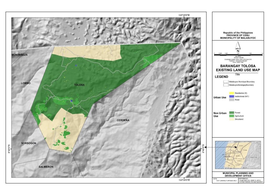
The unique land use distribution of Barangay Tolosa is defined by a blend of natural and urban elements. Roadways occupy 10.23 hectares, residential areas 2.77 hectares, and institutional spaces 0.62 hectares, respectively, reflecting urban use. Tolosa’s land use is primarily natural, consisting of 666.48 hectares of forested area and 299.17 hectares of considerable shrubland. On top of it, 75.06 hectares are used for agriculture. Barangay Tolosa covers 1,054.33 hectares in total.
